You may find data in a wide variety of formats. The challenge is to know which file formats you can convert into a standard format and how to find the software to do the conversion.
Most vector data is in Shapefiles. You may find vector data in other formats but it is best to convert them to shapefiles for use in ArcGIS. Other formats include:
Point data is simpler than polyline and polygon data and can be provided in a simple "table" format.
ArcGIS Pro convert these files to shapefiles using the "X Y Point Data" option in the "Add Data" drop down.
There are a huge number of raster files formats. To use a raster, we need the following information:
We recommend using the IMG file format with ArcGIS and TIFF for other GIS applications. Use ArcGIS Pro, QGIS, or BlueSpray to convert these files.
Note that I am seeing an increasing number of issues with the number of bands in rasters and issues with masks.
See the "Quick Reference" on Jim's site under "resources" for additional information on raster file formats. Other formats can be used to publish maps in reports and web pages.
There are two methods for georeferencing a raster to the earth:
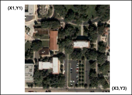
In the first case, the location of the raster is specified (georeferenced) simply by providing the coordinates of two corners of the raster, typically the upper-left (north-west) and the lower-right (south-east). The location of the other corners can be computed by simply combining values form the other corners.
In the second case shown below, one corner has been specified. The location of the other corners are computed using the width and height of the raster in pixels and the width and height of each pixel in "map units". For a LandSat scene the width and height might be 1000 pixels and the width of each pixel would be about 30 meters. This would put the lower-right corner, 30,000 meters to the west and south of the upper-left corner of the raster.
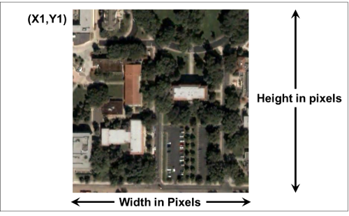
In both cases, the width and the height of the pixels has to be specified.
Raster and Vector data can be obtained in a variety of "complex" formats, such as:
These formats are not recommended for distributing data. Some organizations use File Geodatabase internally which is OK if everyone has access to ArcGIS.
© Copyright 2018 HSU - All rights reserved.